

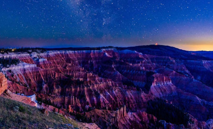
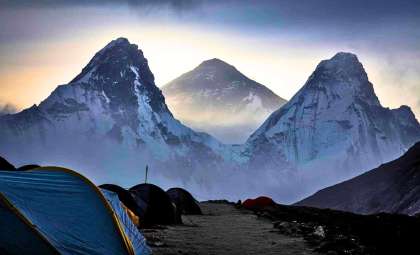
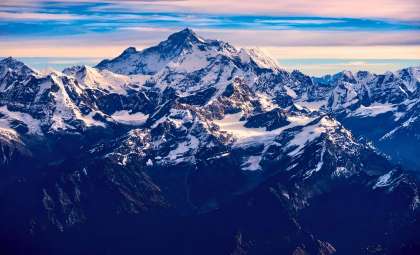
The unique path of the Green River slicing through the Uinta Mountains in Utah has baffled scientists for over 100 years. Recently, a team of experts from the UK and US has pinpointed a deep Earth process called lithospheric dripping as the driving force behind this geological mystery.
The research provides fresh insight into how the Green River managed to carve a 700-meter-deep gorge through a mountain range towering at 4,000 meters. Spearheaded by Dr. Adam Smith from the University of Glasgow, the study suggests that ancient sagging of the Earth’s crust beneath the mountains temporarily lowered the terrain, giving the river an opening to cut its course.
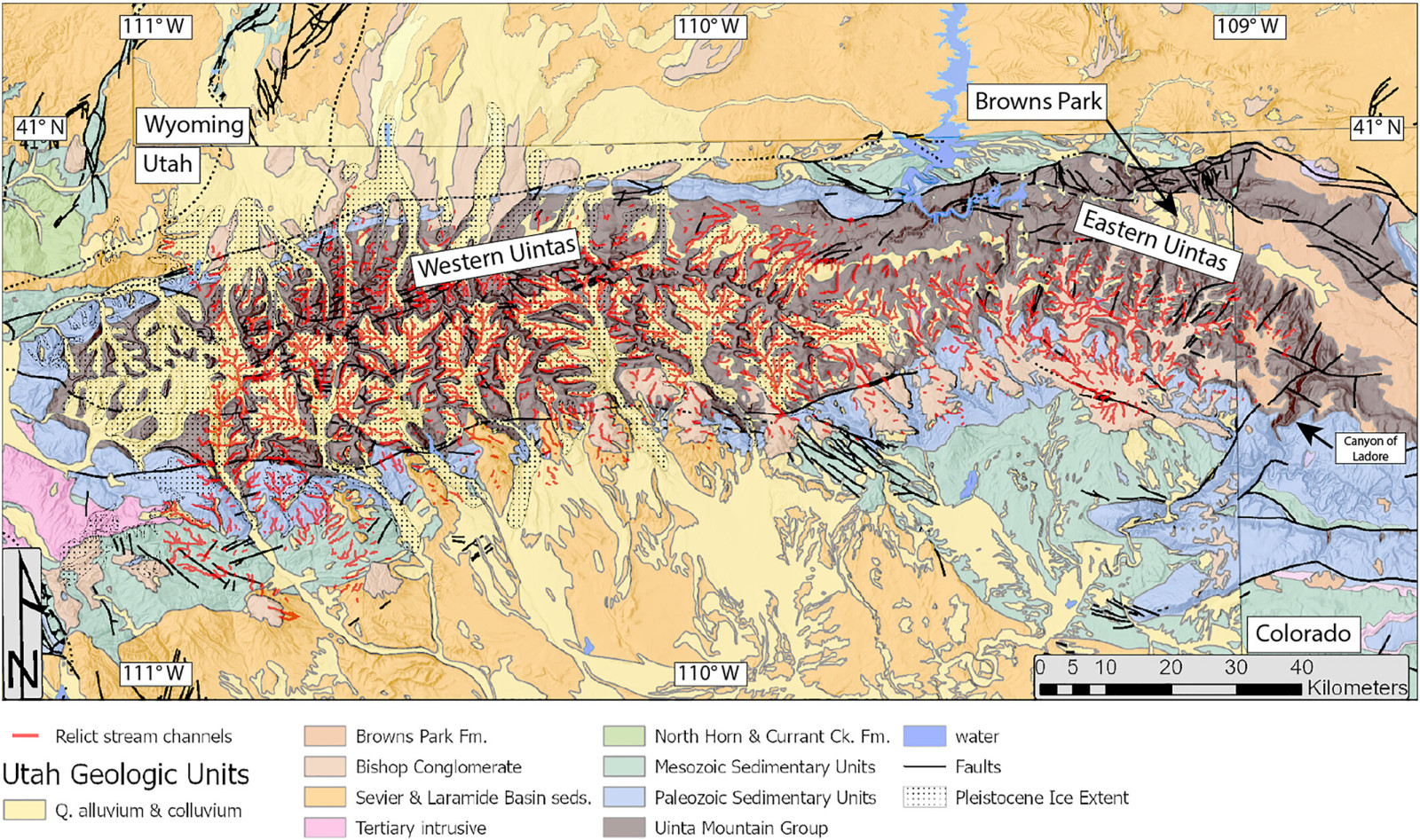
Although the Uinta Mountains, formed about 50 million years ago, should block the river’s passage, the Green River has flowed straight through for at least the past 8 million years. This has resulted in striking features like the Canyon of Lodore before joining the Colorado River. Once a geological enigma of North America, the team employed seismic imaging and sophisticated modeling to uncover the landscape’s unexpected transformation.

Understanding the Lithospheric Drip Mechanism
The concept of a lithospheric drip involves dense material at the lower crust accumulating, then detaching and sinking into the Earth’s mantle. This descent drags the surface downward, altering terrain formation. Dr. Smith explained that they detected a “cold, round anomaly” located approximately 200 kilometers deep and spanning 50 to 100 kilometers, which they interpret as a leftover lithospheric drip.
“We think that we’ve gathered enough evidence to show that lithospheric drip, which is still a relatively new concept in geology, is responsible for pulling the land down enough to enable the rivers to link and merge,” he added.
This downward movement is believed to have created a temporary depression in the landscape. During this phase, the Green River forged its route through the lowered area, eroding rock while the mountains above remained sunken. After the drip broke off and continued to sink, the mountain range rebounded, but the river’s channel had already been firmly carved.
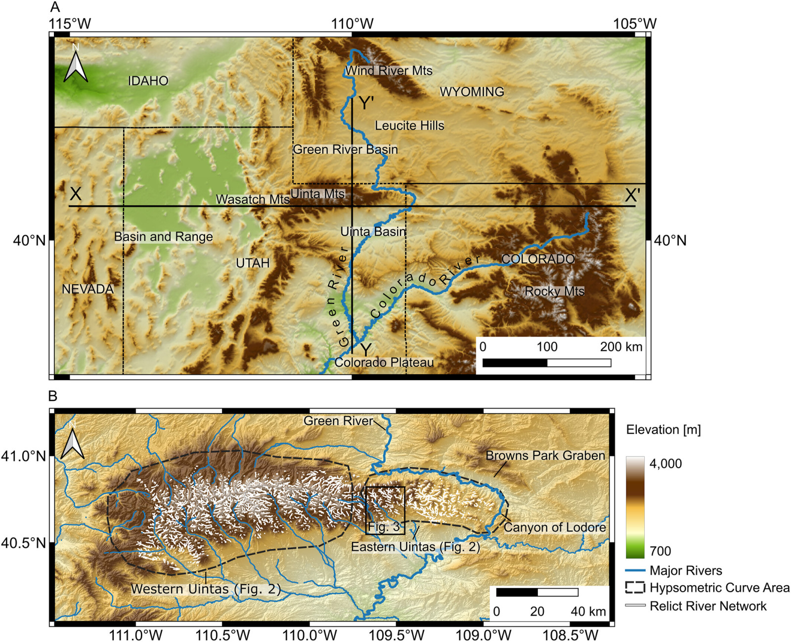
Further evidence comes from identifying a “bullseye”-shaped uplift pattern encircling the Uinta Mountains, a signature feature left after a lithospheric drip event. Additionally, the crust beneath the mountains is thinner than expected for such a large range, supporting the idea that dense material once sank away.
Deploying Seismic Imaging and Modeling Techniques
The team’s conclusions rely on analyzing existing seismic imaging data, which uses earthquake wave transmission to reveal hidden subterranean structures—much like a medical CT scan. This enabled visualization of anomalies far beneath the earth’s surface. The study, published in the Journal of Geophysical Research: Earth Surface, also utilized digital river network models to contrast current elevations with reconstructed ancient landscapes.
The calculated surface uplift from the missing crust closely aligns with the approximately 400-meter height change inferred from erosion patterns. This correlation between physical data and topographic reconstructions strengthens the argument that lithospheric dripping—not tectonic uplift or upstream river capture—explains the region’s topography.
The research challenges earlier hypotheses suggesting the Green River predated mountain formation or that sediment built up enough to let it flow over the range. According to Dr. Smith, none of these alternatives fit as well with the geological evidence or the river’s timing within the Colorado River system.
Impact on Continental Hydrology
The study not only addresses a local geological mystery but also highlights a significant change in North America’s water divide. The Green River’s connection with the Colorado shifted the continental divide, redefining which rivers drain into the Pacific versus the Atlantic. This alteration influenced regional ecosystems and wildlife evolution.
Even though the Uinta Mountains lie in a tectonically stable region, these findings indicate that deep mantle dynamics can drastically reshape Earth’s surface without triggering earthquakes or volcanic eruptions. The scientists stress that lithospheric dripping is a newly recognized process, potentially affecting more landscapes worldwide than previously understood.
“We hope that this paper will help resolve a longstanding debate about one of North America’s most significant river systems,” Dr. Smith said, “and help build the growing body of evidence that lithospheric drips may be the hidden answer to more tectonic mysteries than we’ve previously realized.”
- Categories:
- Science


0 comments
Sign in to Comment