
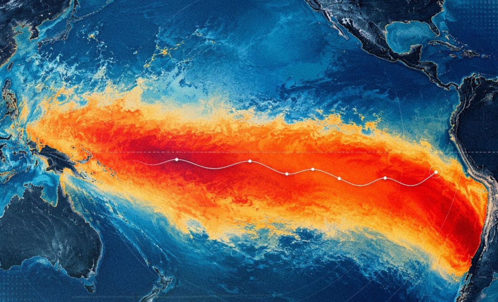
On June 8, 2026, a satellite observed sea surface heights exceeding 15 centimeters above the norm across a vast region of the equatorial Pacific Ocean.
This observation preceded NOAA’s official announcement of a new El Niño by three days, revealing critical information that sea surface temperature alone couldn’t provide: an extensive amount of heat was already stored beneath the ocean’s surface, indicating the 2026 El Niño was intensifying. The satellite responsible for this measurement, Sentinel-6 Michael Freilich, has been monitoring the heat accumulation since early spring, tracking the initial warm water pulses moving eastward across the Pacific.
On June 11, NOAA declared El Niño after sea surface temperatures in the central and eastern equatorial Pacific stayed at least 0.5°C above average for several months, meeting the established criteria. The satellite data enriches this by revealing the depth and scale of the warming, which tends to be a more accurate predictor of the event’s future development.

The Importance of Sea Surface Elevation Over Temperature Alone
When ocean waters warm up, they expand and occupy more volume, causing a rise in sea surface height. This connection allows scientists to use ocean height changes to gauge heat content, not just surface temperature. A thin warm layer on the surface might have minimal impact, but a vast subsurface heat reservoir drives the atmospheric shifts typical of El Niño, influencing the jet stream, redirecting storm paths, and triggering extreme rainfall events far beyond the Pacific region.
Launched in 2020 through a joint NASA and ESA initiative under the EU’s Copernicus Program, Sentinel-6 Michael Freilich scans ocean heights globally every 10 days with extraordinary precision.
According to NASA’s Jet Propulsion Laboratory, a primary function of this satellite is to track Kelvin waves—key to transferring heat from the western to eastern Pacific before an El Niño event. This data provides a broader and more continuous insight into ocean heat dynamics than stationary buoys or surface monitors can offer.
Movement of Warm Kelvin Waves Across the Ocean
Kelvin waves emerge when trade winds over the far western equatorial Pacific weaken and momentarily reverse. Typically, these winds blow east to west; a temporary reversal pushes accumulated warm water eastward.
As the wave progresses over weeks, it thickens the warm surface layer, lowers the thermocline—the dividing line between warm surface water and colder deep water—and reduces the usual upwelling of cold water along the American Pacific coasts. El Niño manifests when multiple waves accumulate warm water against the coasts of Colombia, Ecuador, and Peru.
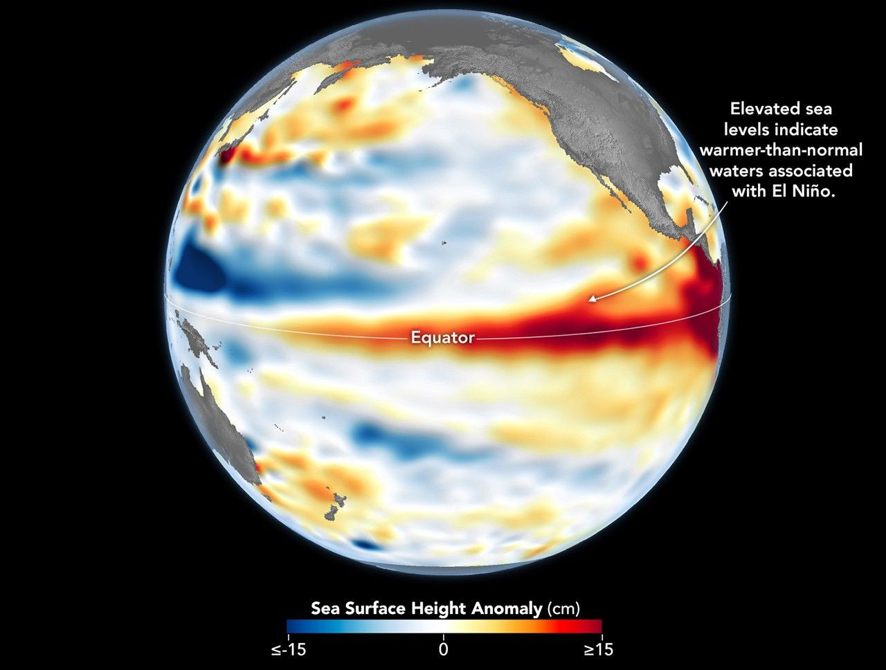
Data from JPL revealed a small Kelvin wave near Micronesia in late January that diminished by mid-February. A larger wave formed in early March, steadily moving east. By mid-May, near Peru, sea levels were over 5.9 inches above long-term averages. Additional warm Kelvin waves were still approaching the eastern Pacific in early June, indicating the heat transfer was ongoing.
Josh Willis, a JPL sea level specialist and Sentinel-6 Michael Freilich project scientist, said, “Although the 2026 event began later than the big El Niños in 2015 and 1997, it is now catching up. We will have to wait and see how intense it becomes.”
June 8 Observations Resemble 1997 Conditions
Researchers paid close attention to the June 8 satellite snapshot because the western Pacific’s conditions resembled those of the same period in 1997, which preceded one of the most powerful El Niños recorded.
Severine Fournier, deputy project scientist for Sentinel-6 Michael Freilich and JPL sea level expert, observed that the eastern Pacific’s warming lagged behind 1997’s pattern, with fewer Kelvin waves accumulated by that date. Nonetheless, her evaluation shifted prior to NOAA’s announcement. “At the moment, it looks like a significant event, more so than I thought last week, but additional data is necessary to predict its full trajectory,” she explained in NASA’s Earth Observatory report.
The difference between moderate and strong El Niño events has major geographical impact. Moderate ones, like those in 2018 and 2023, mainly affected drought and flooding within and near the tropical Pacific, while the 2015-2016 event’s influence stretched further, causing drought in parts of Africa and intense rain in California.
El Niño events usually peak between November and January, so ongoing ocean observations will reveal how far-reaching the 2026 event will be. As Fournier stated in the JPL news release, “Each El Niño differs, but nearly all bring warmer global temperatures and significant shifts in rainfall patterns around the world.”
Currently, Sentinel-6 Michael Freilich is the primary satellite for recording global sea level, a mission that traces back to the 1992 TOPEX/Poseidon launch. Its successor, Sentinel-6B, launched in November 2025 and is expected to continue the mission by late 2026, ensuring uninterrupted long-term ocean monitoring.
- Categories:
- Science








0 comments
Sign in to Comment