
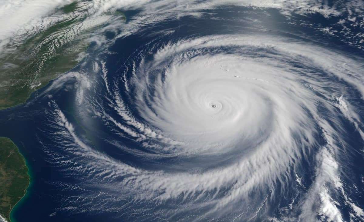
Storm Patty is currently producing winds reaching 95 km/h (59 mph) and a central pressure of 988 hPa, causing heavy rain and strong gusts across the Azores. As it advances northeast across the Atlantic, Patty is forecasted to approach the Iberian Peninsula. While weakening is anticipated, the National Hurricane Center (NHC) warns that unsettled weather could still impact certain regions.
Regions Likely to Experience Effects:
- Portugal: Northern coastal areas near Porto and Braga could face moderate to strong winds accompanied by heavy precipitation. Coastal zones may also encounter heightened wave activity and turbulent seas due to Patty.
- Spain: The northwestern region of Galicia is expected to bear the brunt with significant rain and strong winds. Other northern areas like Asturias and Cantabria may experience heavy showers and rough waters.
- France (indirect effects): Although Patty is unlikely to make landfall in France, areas along the southwestern coast, particularly the Basque Country, might feel increased swell and moderate winds from the Atlantic Ocean.
- United Kingdom and Ireland (possible residual effects): Patty’s remnants could deliver light rainfall and enhanced wave conditions to Ireland and southwestern parts of England, despite weakening significantly before arrival.
Predicted Intense Rain and Flooding Hazards
Forecasts indicate Patty will produce heavy rainfall between 25 to 50 mm (1 to 2 inches) across vulnerable regions, with localized pockets receiving up to 100 mm (4 inches). Combined with strong winds, the storm may elevate flood risks near coastal and riverine zones, especially along the Galician and Portuguese shorelines. The ECMWF weather model anticipates dangerous sea states with waves rising to 3–5 meters (10 to 16 feet) near the coast.
Storm Details and Monitoring
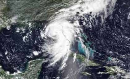
Infrared satellite tracking has revealed Patty’s path and the spread of its rain and wind bands. With sustained winds at 95 km/h and central pressure of 988 hPa, Patty fits the subtropical storm classification, a hybrid between tropical systems and regular cyclones. This enables Patty to maintain considerable strength as it moves into higher latitudes.

Decline into a Post-Tropical Phase
In the next few days, Patty is expected to lose its tropical traits and transition into a post-tropical low-pressure system. This change may continue to bring unstable weather to northern Iberia into midweek. Residual impacts could also cause minor disturbances in southwestern France, Ireland, and southern England, though with limited severity.
This extended Atlantic hurricane season has featured unusual late activity, as demonstrated by storms like Patty. Authorities in the Iberian Peninsula are urged to stay vigilant until Patty fully dissipates by the week’s end.
- Categories:
- Climate change


0 comments
Sign in to Comment