
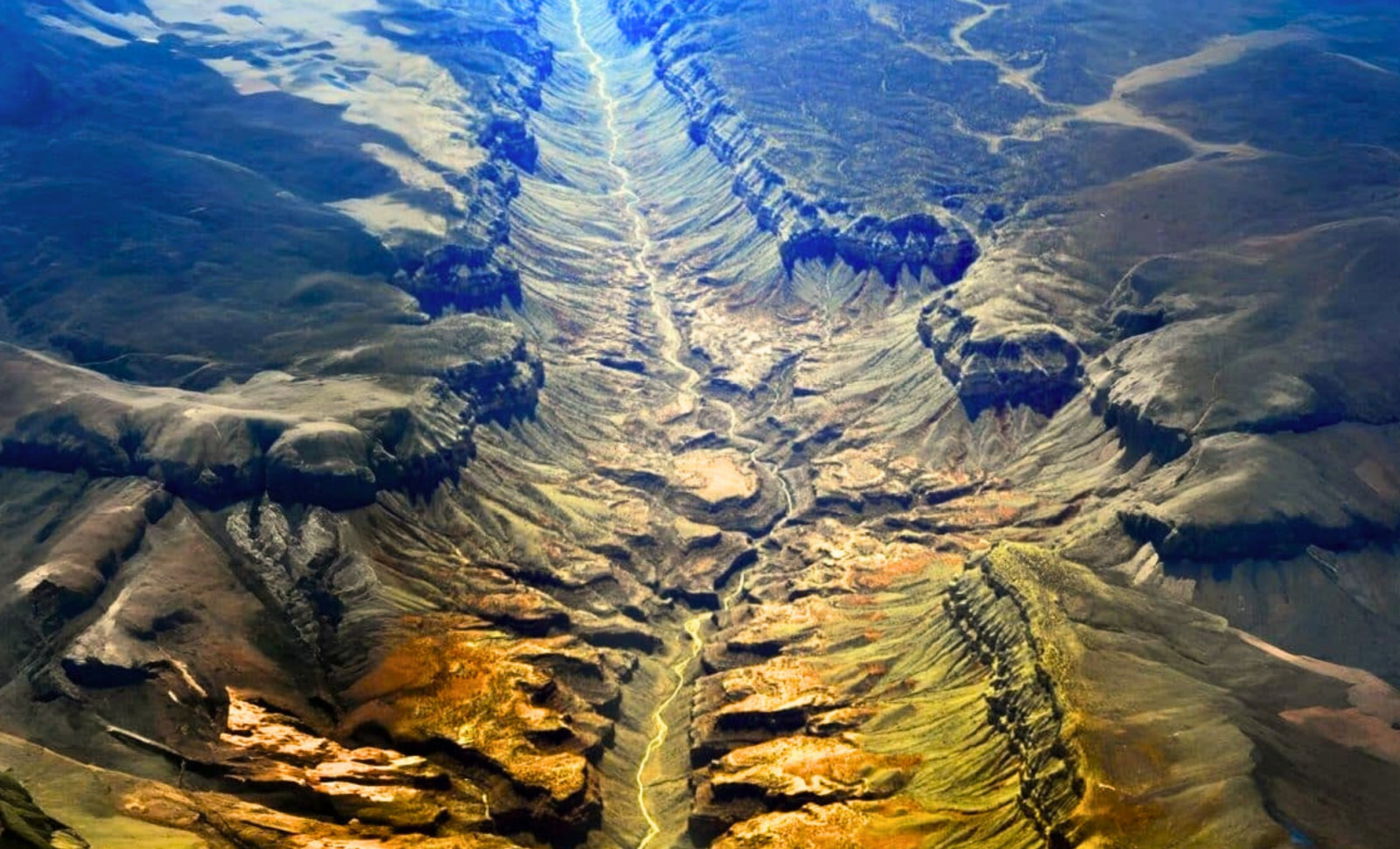
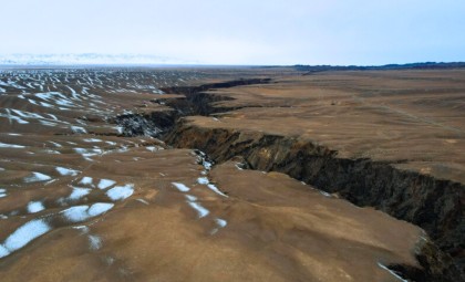
An enormous geological fault slicing through East Africa is actively splitting the landmass apart, unfolding at a pace faster than previously estimated by scientists. Recent findings provide concrete proof of oceanic crust materializing beneath this rift, confirming that this phenomenon is no longer theoretical but a present reality. This fracture is visibly advancing—cracking terrain, dividing roads, and separating agricultural lands.
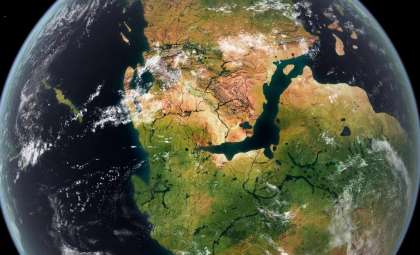
The East African Rift System extends over 3,000 kilometers from the Red Sea down to Mozambique. The rift marks the divergent boundary of three tectonic plates: Nubian, Somali, and Arabian, which drift apart by roughly 0.2 to 0.5 inches each year. Though gradual, such movement accumulates over millions of years to significantly reshape continental features and create vast oceanic basins.
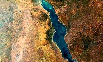
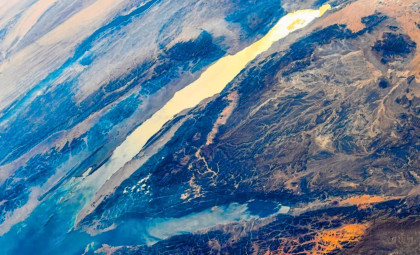
The Arabian Plate’s separation from Africa, ongoing for more than 30 million years, has already produced the Red Sea and Gulf of Aden. The unfolding event between the Nubian and Somali plates mirrors this process in its initial phases. Scientists assert the emergence of oceanic crust in this area goes beyond assumptions and stands as measured fact.

The 2005 Fracture That Redefined Rift Dynamics
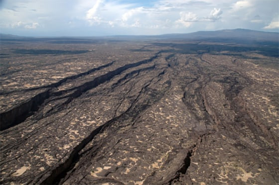
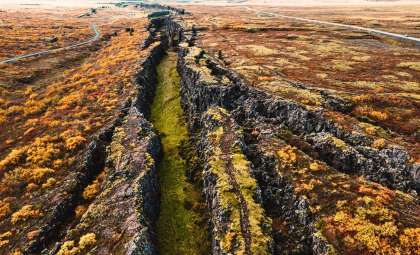
A pivotal moment arrived in 2005 when a 35-mile-long fissure abruptly formed across Ethiopia’s desert terrain. Researchers attributed this dramatic break to tectonic shifts, compressing centuries' worth of usual plate movement into a fortnight. Prior to this event, such rapid rifting had been known mostly through indirect evidence rather than direct observation.
Doctoral candidate Christopher Moore from the University of Leeds tracked ongoing rifting through satellite-based radar. “This location uniquely captures the transition of a continental rift evolving into an oceanic rift,” Moore explained. His sensitive instruments detect subtle ground shifts previously unnoticed by older technologies.
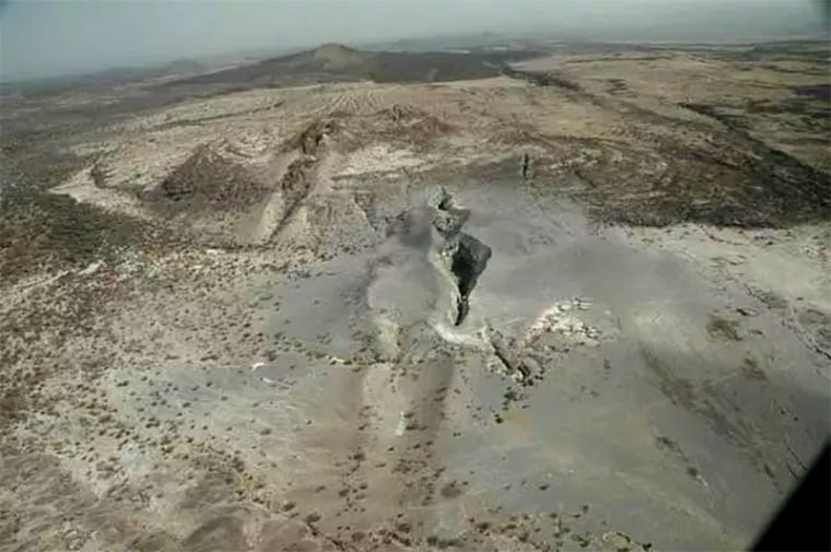
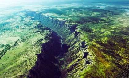
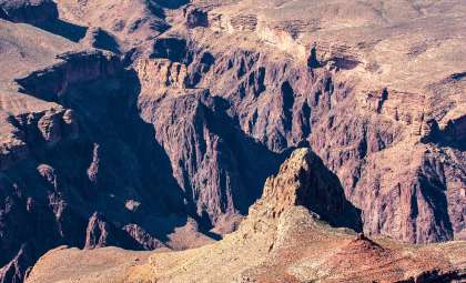
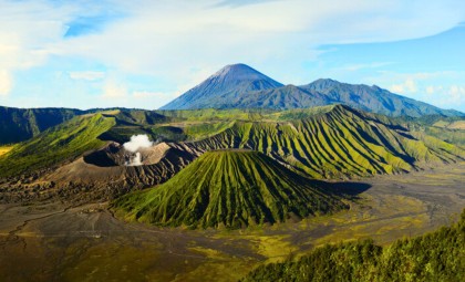
At the heart of this activity lies Ethiopia’s Afar region, notorious for scorching temperatures soaring beyond 130 degrees Fahrenheit. It serves as one of the most intensively studied geological hotspots, offering an unparalleled view of the ongoing transformation from continental to oceanic crust.
The Mechanics of Rifting: Magma and Crustal Forces
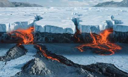
A plume of intensely heated rock ascends from Earth's mantle, exerting pressure that forces tectonic plates apart, resulting in frequent earthquakes and volcanic eruptions. Geologists believe that stress accumulates gradually beneath the surface and is released erratically through sudden events like the 2005 rupture.
Geophysicist Cynthia Ebinger, who has extensively studied the Afar region, described the area to NBC News as resembling "Dante’s inferno." Her observations reveal alternating cycles of calm and intense geological action, likening the process to a balloon inflating to bursting point as magma pushes upward through the crust.
What sets this rift apart is the formation of oceanic crust beneath it—denser and chemically distinct from continental materials—typically only located beneath existing oceans. This discovery confirms that the region is undergoing a rare geological shift, transforming continental land into ocean-floor, a phenomenon rarely witnessed at such an early stage anywhere else on Earth.
The Role of the Red Sea in This Emerging Ocean
Should the rifting persist, waters from the Red Sea and Gulf of Aden may ultimately flood the rift valley, forming a new ocean basin. Current plate separation rates suggest this transformation could span 5 to 10 million years, with direct geophysical evidence observable today despite the immense timescale.
Ken Macdonald, marine geophysicist and emeritus professor at the University of California, Santa Barbara, described observable changes. “As the plates drift apart, material from Earth’s depths rises and creates oceanic crust along ridge systems,” Macdonald said. “We can already observe oceanic crust beginning to materialize.”
When this separation finalizes, sections of eastern Ethiopia, Kenya, and Tanzania will detach from the main continent, resembling an island roughly the size of Madagascar. This shift is not hypothetical—it is already in progress.
Advanced Satellites Reveal Subtle Shifts Once Unseen
For many years, the rift was considered a slow and stable geological feature. However, modern high-precision GPS and satellite radar have unveiled movements on the scale of millimeters, highlighting a much more dynamic and rapidly evolving landscape than previously recognized.
The intense geothermal activity fueling the rift also provides a renewable energy source. Several nations in East Africa are tapping into geothermal power derived from the heat generated by the same processes causing volcanic and seismic events. However, this comes with risks including earthquakes, infrastructure damage, and displacement in zones where the land is actively shifting.
The U.S. Geological Survey’s seismic records from 1900 to 2013 offer one of the most detailed historical baselines on East African Rift activity. Integrating this data with current satellite observations allows scientists to trace the precise evolution from continental to oceanic crust, creating the most comprehensive understanding of this unique geological event to date.
- Categories:
- Science


0 comments
Sign in to Comment